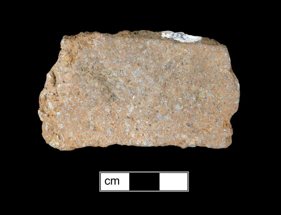
Harmans Area A (18AN29A)
Site History
The Harmans Area A site (18AN29A) is a multicomponent precontact period site containing Early & Middle Archaic short-term camps and Late Archaic through Late Woodland base camps or a village. The site is located on Signal Branch in Anne Arundel County, Maryland.
Archaeological Investigations
This site has been the subject of many archaeological investigations since it was initially identified in 1968 when tree-clearing operations on the western portion of the site exposed the surface area for examination. Six months later, a pipeline was constructed parallel to MD 170, destroying a 40-foot-wide section of the center of the site.
Collector John C. Clark, Sr. and son Wayne Clark conducted a non-systematic avocational collection of the site in 1969, including surface collections and test excavations. The excavation of 13 3 × 3 ft. units and 4 5x5 ft. units revealed a possible hearth feature, as well as Mockley Net Impressed, Potomac Creek Cord Impressed, and Accokeek Net Impressed sherds, triangular and stemmed points. Typed projectile points from the Clark collection, examined by Kinsey in 1979, included 1 chalcedony Amos point, 6 Otter Creek points, 1 Big Sandy, 2 LeCroy-like bifurcates, 10 Late Archaic stemmed points, 1 Brewerton side-notched-like, 4 side-notched, 1 Broadspear/Savannah River-like, 2 Orient fishtail-like, 2 possible Fox Creek/Selby Bay, and 7 triangular points.
Surface collections were made at the site in 1969 by Tyler Bastian, Willard Morgan, and Wayne Clark, followed in 1970 by a surface collection by Rob Gibbs,a summer intern with the Maryland Geological Survey, and in 1975 by Geoffrey Conrad and Spencer Geasey.
In 1977, the site was the subject of investigation by archaeologist Dennis Curry and Spencer Geasey, as part of the reconnaissance of the right-of-way of Maryland Route 170 for the State Highway Administration. Curry and Geasey made further collections from the surface and excavated several small test pits.
In 1979, Dr. Fred Kinsey and six assistants from the North Museum at Franklin and Marshall College, Pennsylvania, conducted Phase II testing efforts at the site. This investigation included the excavation of several 3 × 3 ft and 5 × 5 ft units, as well as shovel test pits. In 1980, Dennis Curry and Terry Epperson returned to the site at the request of SHA and made further surface collections and excavated three STPs at each of the two sites.
In 1986, Engineering-Science conducted combined Phase I and II testing over portion of the airport operations area, including the placement of 12 shovel test pits within the mapped boundaries of the site, as well as collecting a number of quartz and quartzite flakes from the surface. The survey included a single line of shovel tests between the perimeter fence and the fire road paralleling it about 30 meters east.
From October 1990 to January 1991, WAPORA, Inc. conducted a Phase I survey of a proposed BWI Airport runway, including re-identifying 18AN29A. Fieldwork included the excavation of approximately 68 test pits in the Harmans A site. This survey included shovel tests to gather more detailed information on the internal patterning and integrity of archaeological remains. Much but not all of the site area within the perimeter fence has been moderately to severely disturbed. Other evidence suggests at least some areas retain intact subsurface prehistoric components. A few areas yielded relatively dense concentrations of lithic artifacts, primarily debitage.
Phase II testing within the runway project area was recommended and was by Greiner, Inc. Testing focused along the east-west corridor of a dirt road which transverses the northern section of the site. Fourteen shovel tests were placed at approximately 25 m intervals to continue and complete the test grid established during WAPORA's 1991 survey, to further define site boundaries and to measure artifact density and distribution. Thirteen 1x1 m test units were then excavated in areas of high concentration of precontact period artifacts. Precontact artifacts were recovered in all of the Phase II test units. Although numerous shovel tests and 13 1x1 m units were excavated, the presence of only one feature was confirmed just east of MD 170, consisting of a scatter of lithics, fire-cracked rock, and cobbles. No charcoal or staining was evident, and no carbonized plant remains or diagnostic artifacts were found in association. This resembles the "hearth feature" Kinsey identified west of MD 170 in 1979.
In September of 2011, Gibb Archaeological Consulting conducted shovel testing in two transects at 25-foot intervals, with twenty-one of the 38 shovel tests producing 152 precontact period artifacts.
References
2012 Phase I Geomorphological and Archeological Survey of the Kitten Branch Mitigation Site, Baltimore/Washington International Thurgood Marshall Airport, Anne Arundel County, Maryland. (Michael Baker Jr., Inc.) MHT # AN 638.
2012 Phase I Archeological Survey BWI Rail Station Improvements and Fourth Track Project, Anne Arundel and Baltimore Counties. (Straughan Environmental) MHT # AN 620.
1995 Phase II Archaeological Evaluations of the Harmans Site (18AN29A) and the BWI Site (18AN965), Anne Arundel County, Maryland. (Greiner, Inc.) SHA Archeological Report No. 122 MHT# AN 296.
1949 "Some Indian Village Sites of the Lower Patapsco River." Proceedings of the Natural History Society of Maryland, Number 10. MHT # AN 20A.