426-432 North Exeter Street (18BC135)
Site History
Site 18BC135 consists of the archeological remains of six 19th-century rowhouses and an early 19th-century sugar refinery fronting on Hillen and Exeter Streets in a neighborhood north of the Inner Harbor in downtown Baltimore, Maryland. The site was comprised of the backyards and house lots extending from 426-432 Exeter Street and 925-927 Hillen Street. These rowhouse lots were bounded on the north by Hillen Street, on the east by Exeter Street, on the south by an extant building (#424 Exeter Street), and on the west by a concrete-surface alley that originally defined the rear boundaries of the Exeter Street house lots. These lots were originally developed for residential use around 1825, but prior to that, the area had been the site of a sugar refining complex operated by Augustus Shutt. The landscape surrounding the site is heavily developed and the soils are intensely modified from their native state. Soils mapped for the area are classified as "Urban Land" meaning that 80% of the surface is covered either by buildings or by impervious surfaces such as asphalt or concrete.
By the beginning of the 19th century, the City of Baltimore had become the regional leader for the sugar refining industry, with 11 sugar refineries operating in Baltimore by 1825. Though the raw materials were coming from the West Indies, most of the refined sugar was being consumed by the local market. The process utilized by early sugar producers to refine the raw Muscavado and Cassonade sugars imported into Baltimore had been developed during the 18th century. The earliest versions of this process involved heating the raw sugar with lime water and adding raw eggs to coagulate the impurities, which then could be skimmed or filtered off the top. After crystallization had occurred, the partially processed sugar was placed into conical earthenware molds and covered with moistened kaolin clay, which removed the last traces of moisture from the product. The molasses by product was gathered in earthenware crocks into which the molds had been inverted. This refining process, which involved the use of thousands of crocks and required vast amounts of floor space, dominated the industry until ca. 1850, when the vacuum pan process and the use of centrifugal force were adapted to produce sugar more quickly.
In 1804, Augustus Shutt and John Tool acquired part of the property comprising Site 18BC135 under the terms of a 99 year lease from Richard and Elizabeth Curson and Rebecca Russell. The property at that time was recorded as "Lots #83 and #84." The relatively low annual rent of $76 suggests that the parcel contained at best only minimal improvements. The 1804 Baltimore Directory listed the firm of Tool and Shutt as sugar bakers. Either to finance the sale of the property, or (more likely) to provide start-up capital for their business, the partners apparently placed the property for collateral for a $1,000 loan from Philip Horn and Michael Shorr. Within four years, the partners were able to purchase the property outright.
In the following year, the refinery complex again expanded when Tool and Shutt acquired Lot #85, a parcel immediately south of their original property for $600 from Andrew Thompson and Samuel Taylor. The purchase of this lot expanded the total property owned by the firm to an area measuring 80 × 114 ft. Comparison of these measurements to those on modern Sanborn maps indicates Site 18BC135 consists of the archeological remains of six 19th century rowhouses and an early 19th century sugar refinery fronting on Hillen and Exeter Streets in a neighborhood north of the Inner Harbor in downtown Baltimore, Maryland. The site was comprised of the backyards and house lots extending from 426-432 Exeter Street and 925-927 Hillen Street. These rowhouse lots were bounded on the north by Hillen Street, on the east by Exeter Street, on the south by an extant building (#424 Exeter Street), and on the west by a concrete-surface alley that originally defined the rear boundaries of the Exeter Street house lots. These lots were originally developed for residential use around 1825, but prior to that, the area had been the site of a sugar refining complex operated by Augustus Shutt. The landscape surrounding the site is heavily developed and the soils are intensely modified from their native state. Soils mapped for the area are classified as "Urban Land" meaning that 80% of the surface is covered either by buildings or by impervious surfaces such as asphalt or concrete.
City directories continued to list Augustus Shutt as a sugar refiner through 1829. Shutt lived on the refinery property with his wife, Margaret, their 6 children (4 girls and 2 boys), and 2 or 3 additional residents (probably sugar refinery workers). By 1820, the household also included a female African-American, probably a maid.
Augustus Shutt died "an old and respected citizen" at the age of 50 in July of 1829. Her children having married and established their own households and businesses elsewhere, Margaret Shutt apparently subdivided and sold the refinery property between 1829 and 1846. Baltimore Tax Assessors' notebooks for the latter year indicate that Margaret occupied only a brick house on a 38 × 80 ft lot. The remaining portions of the former sugar refinery had been divided into five lots. Two lots measuring 19 × 80 ft each were owned by John D. Becker and Sarah and Susan Fowler. Three lots, each measuring 13 × 80 ft, were owned by Samuel Williams, Philip Schwarer, and John and Richard Cross. The total dimensions of these subdivided lots measured 80 × 115 ft, conforming almost precisely to the dimensions of the original sugar refinery parcel.
The most intensive development within this area occurred during the second third of the 19th century, after the demise of the sugar factory. Hillen Street was surveyed and established in 1825, as the expanding population and the property developers in the area required additional transportation facilities. By the mid-19th century, the area was almost completely residential, particularly those properties near the corner of Hillen and Exeter Streets. Tax records suggest that the dwellings along Hillen Street may have been constructed by one or two individuals for investment purposes, since their lots and the buildings all were configured similarly and all were occupied by tenants. The Exeter Street properties featured 2 and 3 storey row houses with relatively deep and spacious rear yards. Census records and fire insurance maps indicated that these dwellings were occupied primarily by native-born Americans until the last quarter of the 19th century, when Russian and Italian garment factory workers moved in. Most of the dwellings retained their residential function through at least the first third of the 20th century, a fact confirmed by the information contained on the Sanborn Fire Insurance maps and by aerial photographs of the newly completed Orleans Street Viaduct ca. 1934.
The properties along the 900 block of Hillen Street contrasted with the more spacious parcels on Exeter Street. The lots on this portion of the block measured only 40 ft deep and 12 ft wide, and the rear yards of #927 and #929 Hillen Street abutted those of the larger lots aligned along Exeter Street. As the 19th century progressed, these modest dwellings were increasingly occupied by skilled immigrant families from Russia, Italy, and Germany. Many of the dwellings assumed a semi-commercial function, as they were modified to accommodate stores or shops on the first floor and apartments for one or more families on the upper floors. The 1910 residents of the 925-927 properties are particularly interesting, in light of the archeological materials obtained from the common privy for these dwellings. Fred Castagna and his wife, both Italian immigrants who lived at 925 North Hillen Street, owned and operated a lunch room. Their next door neighbors at 927 Hillen Street were Edward and Vera Hahn, German immigrants who owned their own upholstery business.
Archaeological Investigations
Site 18BC135 was first investigated beginning in 1996 as part of a combined Phase I, II, and III archaeological investigation undertaken at the site of a new Juvenile Justice Center in Baltimore, MD. The site of the (then) proposed Baltimore Juvenile Justice Center encompassed two heavily developed blocks that the Shutt sugar refinery property occupied the entire northeastern quadrant of the block, and included parcels that later were numbered as 426-432 Exeter Street, and 927-929 Hillen Street. The same entry described the buildings that stood on Shutt's property as including a four-story brick sugar house, a two-story brick dwelling, a store, and two additional houses.
A total of eight archeological sites were the subject of the investigation at the Phase I/II level of inquiry and at 18BC135 work would eventually expand to a Phase III level of inquiry. These investigations were required under the terms of Section 83-B, Paragraphs 6-517 and 5- 618, of the Annotated Code of Maryland, and pursuant to the terms of a Memorandum of Agreement concluded between the Maryland Historical Trust (MHT) and the Department of Juvenile Justice (DJJ).
In order to locate sites, fieldwork initially employed the mechanical removal of overlying modern features or surfaces, followed by the excavation of 5 m long mechanized trenches to assess stratigraphy and site integrity of the underlying deposits. The size of trenches were sometimes altered to better delineate features and to accommodate conditions in the field.
At 18BC135 one mechanized trench was placed within the northeast quadrant of Block 41, approximately 19.8 m (65 ft) south of Hillen Street and adjacent to the alleyway that bisected the block. This location corresponded to the extreme rear yard of the property at 430 N. Exeter Street. Stratigraphy within the mechanically excavated trench was recorded on excavation unit sheets, utilizing standard pedological nomenclature and Munsell readings. Stratigraphy and identified features were also drawn in plan view and were photographed in both black and white and color. To reduce the potential for sampling bias, a uniform 15-gallon volumetric sample was recovered from each mechanically excavated natural/cultural stratum. These soils were screened through hardware mesh and all cultural materials recovered from this procedure were retained for analysis.
Removal of the asphalt parking surface and its mixed sand and gravel fill underlayment immediately exposed a surface composed of disturbed mixed fill that covered and surrounded a complex of six associated features. These included: an unmortared brick foundation enclosing a presumed square brick privy or well shaft, a brick walkway immediately north of the privy, a concrete slab northeast of the privy, and three other discrete brick wall segments.
After all related features had been mapped, the upper portions of the interior fill of the privy shaft were tested manually to a depth of 100 cm below datum. Exposed strata were noted and documented in profile on standardized forms and with photography and identified artifacts were retained.
The topmost cultural strata within this feature exhibited a complex sequence of fill episodes that included lenses of white gravel fill and black organic soil with brickbats and architectural debris, followed by a partial clay cap underlain by reddish-brown gravel. At a depth of 38 cm below datum, the feature fill subdivided into two contiguous lateral sections that were separated by a pipe and a line of unmortared brick (i.e. a utility trench). Each of these sections was removed separately. The reddish-brown gravel stratum surrounding the pipe in the eastern half of the unit continued to a depth of approximately 80 cm below datum. In the western half of the unit, a grayish-brown sandy clay with gravel gradually expanded eastward to comprise all of the undisturbed feature fill.
The artifact sub-assemblages recovered from this test unit contained typically domestic materials with termini post quem of 1890 or later. It was clear that the upper 100 cm of fill within the feature, including that within the utility trench, constituted modern deposits. However, the fact that these features could be recognized stratigraphically suggested that the remaining historic fill episodes within the shaft also could be intact. Moreover, the results of the Phase II investigation suggested a high potential that deposits and features relating to other rear yards of the former Exeter Street dwellings might be intact immediately underneath the asphalt paving. Based on these findings Phase III data recovery was undertaken.
During the initial stage of Phase III excavations an approximately 4.6 × 22.9 m (15 × 75 ft) rectangular area was stripped of asphalt and underlayment to expose soils below the existing parking lot. This process exposed an 104.5 square m (1125 square ft) area and revealed a total of 11 features (including more of the rectangular well/privy shaft previously identified and tested during the Phase I/II investigations) and stratigraphically distinct surfaces that appeared to conform to property boundaries. The features were assessed with the excavation of six 1 × 1m test units. These test units were excavated in 10 cm levels within natural/cultural strata. Two liter soil samples were also retained from each natural/cultural stratum or from each 60 cm level of each privy shaft for flotation. Three additional units also were excavated to test stratigraphically distinctive surfaces, but no significant features were ultimately identified in these 3 units. The same area was then re-stripped to a depth of between 58 and 75 cm below datum to look for earlier living surfaces, and the mapping and testing regime was repeated. This secondary exposed area included the rear yards of four rowhouses along North Exeter Street (#s 426-432) and two rowhouses that faced North Hillen Street (925-927 Hillen Street). This procedure exposed 26 additional features, including three additional privy shafts, brick foundations, a minimum of four barrel privies, and various post holes and utility trench lines.
Due to the unexpectedly large number of features identified following the second stage of stripping, not all features could be excavated. Proposed development for this portion of the Juvenile Justice project area included only the installation of a moderately intrusive asphalt-surfaced parking lot, however, construction of a multi-level parking facility was a possibility at some time in the future. Plans for the surface parking lot called for removal of approximately 91 cm (3 ft) of surface fill and introduction of aggregate underlayment, a process that would truncate the upper portions of several shaft features. The strategy ultimately decided upon was to bisect all of the additional exposed privies (including barrel privies) and removal of a 50% sample of their contents to a depth of 1 m. The plan anticipated that the proposed construction of the parking lot then would preserve the remaining contents of these shaft features, which could be investigated further if and when additional construction occurred.
On or about May 31st, 1998, shortly after the plan for excavating privies had been agreed upon, Site 18BC135 was subjected to severe vandalism. Two apparent bottle collectors forced access into this site by cutting the gate locks in the construction fencing. Within one weekend, these individuals totally emptied one (partially tested) brick-lined privy to a depth of 2.4 m (8 ft), and removed an undetermined amount of fill from two brick-lined round privy shafts. The perpetrators deposited all "undesirable artifacts" together with the removed privy fill adjacent to each shaft feature.
Field technicians photo-documented the degree of disturbance, obtained a random 4 liter sample of representative items from areas adjacent to each vandalized shaft, and filed a report with the Maryland Historical Trust and the Maryland Department of General Services, for use in possibly prosecuting the perpetrators. The assemblage thus obtained was treated like a series of surface-collected field specimens.
Phased removal and investigation of the features across the exposed back yards of the six property lots that comprised Site 18BC135 revealed structural elements related to four basic phases of development of this area and confirmed the basic chronology of the area as represented by archival research.
Between 1804 and 1835, the entire property encompassed within the site boundaries was associated with the sugar bakery of Augustus Shutt and John Tool. At its height, the physical facilities associated with Shutt's operation included the sugar house itself, a store, Shutt's own dwelling, some housing for refinery workers, and probably other ancillary structures. Features that could be related to the sugar refinery period included two main structural walls of the refinery itself (foundation remnants), a square well or privy shaft used primarily for disposal of the broken sherds of sugar molds and their accompanying jars, a truncated barrel well/privy, and a vestigial fence line or shallow robber trench of unknown function in the southern part of the sugar refinery property. The association of many of the features with the sugar refinery period was made not only on the basis of the material culture derived from the features themselves, but also from the location and orientation of the feature complex, which straddled and cut through later property divisions.
Both the debris deposits in the basement of the sugar factory and those associated with the earliest surviving deposits contained within the square privy/well shaft document the earliest type of sugar refining operation practiced in the United States. Shutt's sugar bakery reflects an early technology that succeeded largely because of Baltimore's position as a major port of entry for the Middle Atlantic region. His refinery had counterparts in other port towns in the region, including Alexandria and the District of Columbia. All had similar histories, in that all were established during the early 19th century in reaction to the interference imposed by the British on international trade during the Napoleonic Wars. By the 1830s, if not before, all had ceased to operate.
In terms of the associated material culture, the results derived from examination of the features associated with the Shutt sugar refinery are comparable to those obtained by the excavations at the Alfred Street sugar house in Alexandria. There, as at 18BC135, the most prevalent artifact types were the sugar molds/cones used in the manufacturing process. Fragments of these vessels were especially concentrated within the foundation of the sugar house and in the square brick-lined shaft located within the sugar house foundation. The associated molasses syrup collection jars with their glazed interiors and heavy everted rims (that permitted the insertion of the inverted sugar cones) also were in evidence, although not in relatively abundant quantities.
The artifacts assemblage from both the Alexandria site and the Shutt sugar factory site also displayed somewhat anomalous categories of materials, although not similarly. Researchers at the site in Alexandria recovered numerous lumps of clay, pieces of iron and copper, and large quantities of anthracite coal and clinkers that they interpreted as expended fuel residue from the manufacturing process. At 18BC135, the anomalous class of artifacts (recovered from the same contexts as the sugar cones and therefore presumably also associated with contemporaneous activities) were an extraordinarily large numbers of fruit pits (particularly cherry). Their association with the manufacturing activities carried out at the Shutt’s factory is unclear. One possible hypothesis is that Shutt also may have engaged in the manufacture of alcoholic fruit drinks such as brandies or cordials. Unfortunately, given the absence of a will or estate inventory for Augustus Shutt, it is likely that this idea will remains hypothetical.<
After Shutt's death and the cessation of sugar refining on the site, the large property was subdivided and developed as smaller residential properties. Margaret Shutt continued to occupy one dwelling in the area, but at least five other homes of the traditional Baltimore brick rowhouse design were constructed on the property. The rear walls of three dwellings (927 North Hillen, 432 and 428 North Exeter Streets) defined the perimeters of the backyard living spaces. Individual brick-lined privies were installed at the rear of all the Exeter Street lots except, strangely, on the #430 North Exeter property. Each of these facilities would have been enclosed in some type of structure. The partially intact brick foundation of one such structure was documented around the facility at the rear of the 426 North Exeter Street lot. These privies defined the extreme rear of each property and butted an unnamed interior alley through which access to the back yards could be gained.
In contrast, residents of the smaller dwellings and properties that were built along North Hillen Street lacked at least one amenity enjoyed by their neighbors: a separate privy. The adjacent properties at 925 and 927 North Hillen Street were served by a single brick-lined oval privy that probably was housed in a frame structure for which no features survive.
Documentation showed that after the Civil War, the formerly all residential properties became more intensively occupied and thereby more intensively utilized. Two aspects of the archeological record seem to speak to the intensification and crowding within the site area.
Scrutiny of the 1890 Sanborn map configuration of these lots did not suggest that more intensive utilization resulted in the construction of additional structures. However, census data for the years 1880 and 1920 indicate that the formerly single-family occupation pattern, particularly in the townhouses along North Exeter Street, changed significantly. Moreover, commercialization of some of these properties may have necessitated the installation of separate "work" and "domestic" sanitary facilities (though nothing in the archeological record seems to suggest such a dichotomy. Nonetheless, in the absence of central collection of sewage and indoor sanitary facilities, the increase in the number of people living in dwellings designed originally to house single families certainly would have stressed existing facilities and necessitated the installation of auxiliary structures such as barrel privies. Barrel privies were an expedient measure to handle the increased demands placed by expanding populations in the neighborhood.
It also is possible that, with relatively many people needing to use space within a limited finite area for a variety of functions (both residential and commercial), redefinition of yard space through the use of fences became necessary. Such structures would have divided an area that appeared to function as a "common" area for dwellings along Exeter Street into discrete units. No real fence post lines appeared in any earlier contexts.
The coming of the automobile and the extension of modern centralized sanitary sewer, storm sewer, and water systems into all of the neighborhoods of Baltimore had the most profound influences on the site area, both in terms of their impact on the neighborhood and its residents and on the archeological record. The archeological signatures of these trends were seen in the utility trenches, containing both water and sewer lines to individual residences or properties, within the neighborhood. Each dwelling eventually was connected to the centralized lines, and became, in that respect, part of Baltimore City, nearly two centuries after the area was politically incorporated into the city.
The automobile and the needs it spawned also had direct and indirect effects on this portion of the Juvenile Justice Center project area. The increasing traffic generated by the automobile resulted in the construction of the Orleans Street viaduct, which segregated these dwellings from what historically had been a mixed commercial and residential neighborhood centered on the stores and shops of the Gay Street corridor. Moreover, the automobile and the need for space to park within the inner city ultimately resulted in the demolition of these 19th century structures, sealing their remains and those of earlier structures under layers of compacted clay fill, sand, and gravel underlayment, and asphalt.
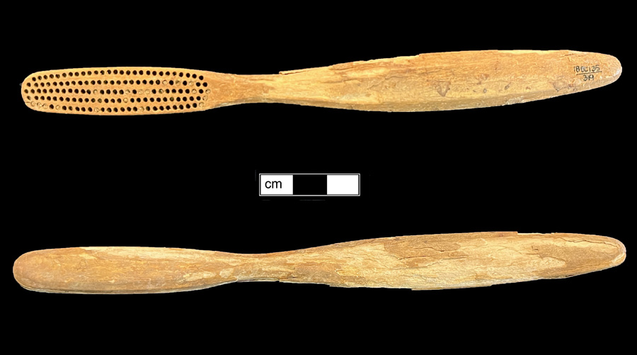
Reported artifacts recovered from the excavated features and from the vandal pits at 18BC135 included 2,647 activity items (including 1,445 industrial objects and 1 transportation item), 3,212 architectural artifacts, 97 clothing items, 58 furniture items, 9,238 kitchen-related items, 81 personal objects, 13 arms items, and 1,059 miscellaneous objects. The kitchen assemblage included at least 13 creamware sherds, 56 pearlware sherds, 8 early porcelain sherds, 23 late porcelain sherds, 79 whiteware sherds, 26 ironstone sherds, 3 yelloware sherds, 87 redware sherds, 17 miscellaneous stoneware sherds, and 133 faunal specimens.
As mentioned previously, flotation samples were also collected from selected features, some of which produced ethnobotanical assemblages useful for interpretation. Within the brick-lined privy that contained all of the material related to sugar refining, samples from the upper layers of fill were quite different from those derived from lower levels of fill. The upper levels contained only one type of seed: raspberry/blackberry. This suggested that some elements of these upper strata may have been derived from privy fill. The lower strata, however, contained a very wide variety of botanical remains. A large proportion of the recovered remains included a large proportion of fruits such as paw-paw, watermelon, cherry, plum, and cultivated grapes. The difference here was so remarkable that it suggested that some other type of manufacturing, such as the production wines or brandies, might have been taking place at the sugar refinery (see above). The only other feature reported to produce relevant ethnobotanical materials was another brick-lined privy (circular in shape). It produced a few raspberry/blackberry and grape seeds. However, these could easily be associated with routine consumption of fruit.
The excavations at 18BC135 revealed numerous intact features, many of which were capable of addressing significant research questions related to the history of Baltimore. Site 18BC135 is now the location of the Baltimore Juvenile Justice Center. However, not all of the features identified during the work of the late 1990s were excavated, and many may be preserved beneath the surface parking lot that was constructed for the facility. If the parking infrastructure should be expanded into a parking garage or another facility be constructed which would impact the currently capped and protected archeological deposits at 18BC135, additional work should be carried out.
References
2000 Phase I, II, and III Archaeological Investigations at the Juvenile Justice Center, Baltimore, Maryland. Final report submitted to the Maryland Department of General Services. On file at the Maryland Historical Trust, Crownsville, Maryland.
Associated Artifacts
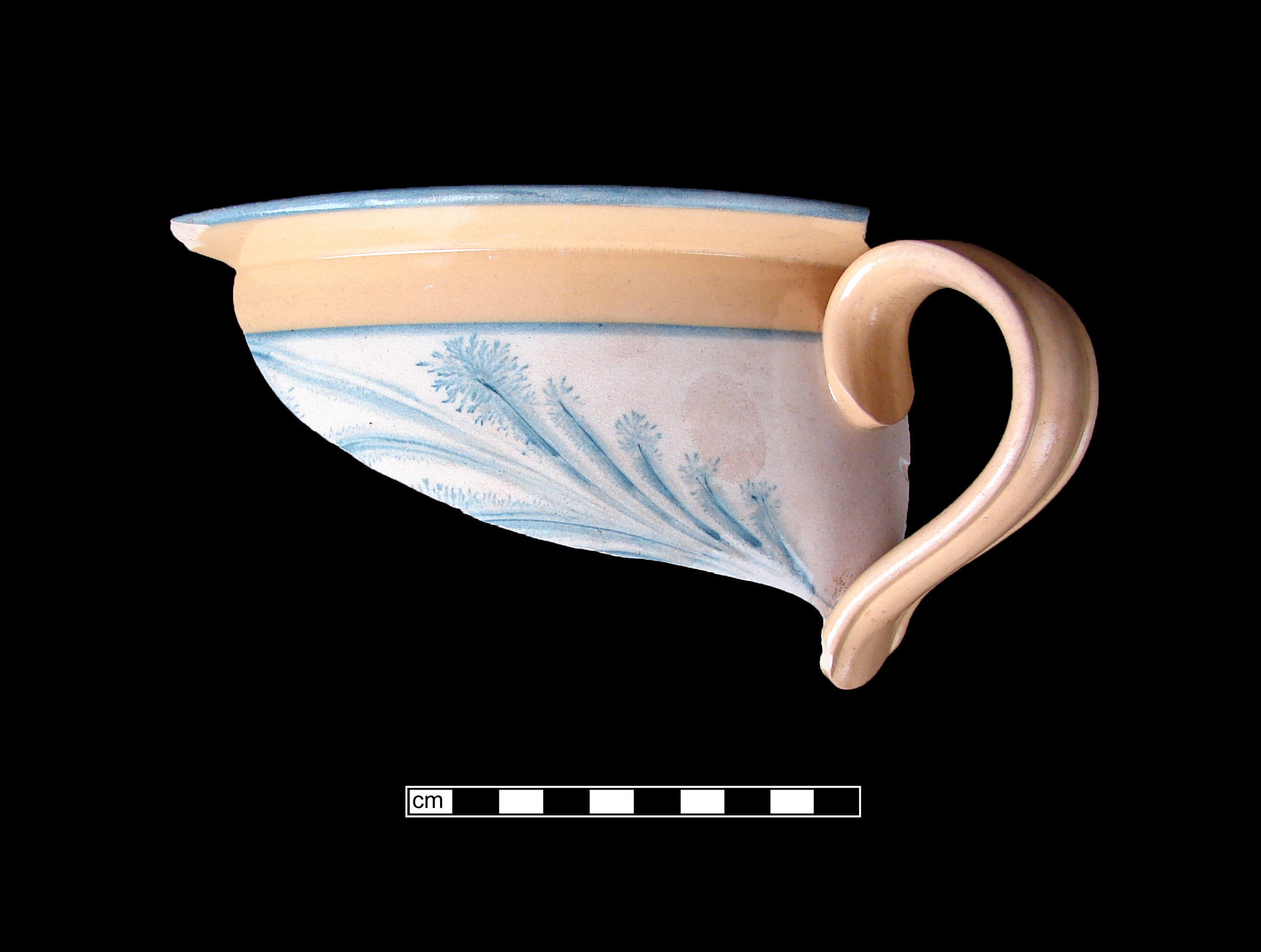
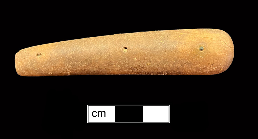
Knives
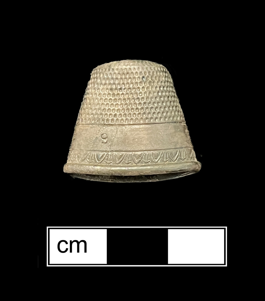
Thimbles