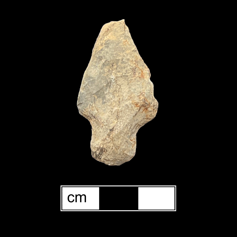
Mataponi Creek (18PR16)
Site History
Mattaponi Creek (also known as Fenno) is a multi-component pre-contact site spanning possibly as early as the Paleoindian period, Late Archaic, and the Early through Late Woodland periods. Formerly known as Fenno Farm, the site is now a part of the Merkle Wildlife Sanctuary that is maintained by the Maryland Department of Natural Resources. A number of avocational collections from this site are known.
Archaeological Investigations
The site's location was first documented by avocational archaeologist Richard Stearns in the 1930s on the west side of the Patuxent River and the south side of Mattaponi Creek. Stearns observed numerous projectile points and Potomac Creek ceramics within the site and within a collection made by the property owner, Mr. Fenno (Stearns 1951). Material collected by Stearns and donated to the Smithsonian was later cataloged by Laurie Steponaitis in 1980. Diagnostic points included Otter Creek, Holmes, Fishtail Type, and Rossville points. Diagnostic ceramics included predominantly Potomac Creek, though single sherds of Accokeek and Mockley were also present (Steponaitis 1980).
A limited Phase I archaeological survey was conducted on the northeast periphery of the site in 1977 by Joseph McNamara of the Maryland Geological Survey prior to the construction of an observation tower and parking lot. While no artifacts were found during testing, McNamara did observe artifacts on the surface within the site. Debitage of quartz, jasper, and quartzite were found in addition to a single rhyolite Lehigh/Koens Crispin point and an unidentified point (McNamara 1977).
The site as defined by Stearns was vaguely described and was thought to encompass a large area of about 30 acres. Site boundaries were redefined by Mary Barse of the Maryland Geological Survey in 1987, which split off 18PR16 and recorded two additional sites, 18PR348 (lithic and historic artifact scatter) and 18PR349 (18th/19th century structure). Barse excavated a 1-meter square test pit that included a thin midden layer below plowzone and the remnants of two trash pits. Artifacts within these features included hundreds of sherds, including Accokeek, Mockley, and Townsend ceramics (Barse 1988).
Robert Ogle, a notable collector in the region, had also visited the site over the course of several years. Ogle collected 29 artifacts from the site, including a possible Hardaway Side-Notched point dating to the Late Paleoindian period and an Adena point made of rhyolite from the Early/Middle Woodland period. Other diagnostic points included Lamoka, Piscataway, Savannah River, Vernon, Calvert, and Levanna points. Diagnostic ceramics consisted of Mockley and Townsend wares (Chisolm et al. 2021).
References
1988 A Preliminary Archeological Reconnaissance of the Middle Portion of the Patuxent River, Charles, Calvert, Prince Georges, and Anne Arundel Counties. MGS File Report No. 219, Maryland Geological Survey.
2021 Enhancing the Ogle Archaeological collection from Central and Southern Maryland. 2 Volumes, Anne Arundel County Planning and Zoning Cultural Resources Section.
1977 Archeological Reconnaissance of the Proposed Observation Tower and Parking Facilities at Merkle Wildlife Management Area, Prince George's County, Maryland. MGS File Report No. 97, Maryland Geological Survey.
1951 An Indian Site Survey of the Patuxent River. Maryland Naturalist 21, Issue 1-2.
1980 A survey of artifact collections from the Patuxent River Drainage, Maryland. MHT Monograph Series No. 1, SUNY, Binghamton.