McAlpine (18PR259)
Site History
The McAlpine site (18PR259) is a mid-19th- to 20th-century farmstead and mid-20th-century school site located in the Hyattsville area of Prince Georges County, Maryland. The MacAlpine Estate was built circa 1868 by Charles Baltimore Calvert, on land that he received as part of his inheritance upon the death of his father, Charles Benedict Calvert. This property had once been part of the Riversdale Estate. The site was used as a working farm by the family until 1890, after which time it was used as a summer house. In 1934 the property became the Longfellow School for Boys. The last building, the main house, was destroyed in the 1950s. The barns and other outbuildings were located primarily south and east of the main house. Little is visible on the property today except for a concrete walk and stairs east of the site. Much of the estate had been acquired by the federal government during World War II for use as subsidized housing, known as the Calvert Homes development (18PR260]), for workers at the nearby ERCO factory and subsequently by returning soldiers as part of the G.I. Bill.
Archaeological Investigations
This site was identified in November of 1984 by John Milner Associates during a Phase I survey for the proposed realignment of Calvert Road. Archaeological deposits associated with the site were very disturbed due to construction associated with the Calvert Homes development. The 19 units excavated on top of the hill did not produce any 19th-century artifacts.
In 2008, Applied Archaeology and History Associates conducted a Phase I survey of the 36-acre property on which 18PR259 lies. A pedestrian reconnaissance revealed that the study area had been greatly disturbed by the Calvert Homes development, with evidence of roads, sidewalks, and concrete housing pads still discernible. In the western portion of the study area, however, the remains of some buildings associated with the MacAlpine Estate (18PR259) were still identifiable and included the icehouse, the possible remains of the smokehouse and the brick-built barn, and a concrete cellar hole that may represent the foundations of the MacAlpine manor house.
Subsurface testing of the study area confirmed that the construction and subsequent demolition of the Calvert Homes development had disturbed or destroyed much of the evidence for the earlier occupations. The eastern portion of the property appeared to have been particularly disturbed and this is reflected in the density of the Calvert Homes development in this area (18PR260). In total, 172 shovel test pits were excavated across the study area at intervals of 15m. Only three shovel tests contained artifacts that were temporally diagnostic of an occupation that occurred earlier than 1924. All of these STPs were located in the western half of the study area (18PR259), close to the main building complex of the MacAlpine Estate. The only other temporally diagnostic artifacts that were recovered during the excavations were recovered from the ground surface in and around the icehouse, which appears to have been used as a trash pit after it fell out of use as an ice store. AAHA recommended no further investigation of Area B and combined the MacAlpine (18PR259) and Calvert Homes (18PR260) sites into one site, 18PR259, on the grounds that the overlap precluded any meaningful division. Their recommendation identified the MacAlpine component as potentially significant, not the Calvert Homes component.
Phase II/III excavations were conducted by Gibb Archaeological Consulting in 2012 and 2013.The Phase II archaeological site examination consisted of limited testing (shovel tests, 3 ft by 3 ft excavation units, probing and trenching). Three trenches and surface mapping documented high levels of disturbance to the circular icehouse which had served as a domestic refuse dump probably into the late 1950s. Most of the upper courses of brick had been removed, the usable bricks removed from the site and the broken pieces and waste mortar scattered on the surface.
Additional testing suggested that the structure identified in the 2008 work as a bank barn was probably a carriage barn. Brick and mortar rubble filled the interior of the building which measured 25 ft east-west and more than 25 ft north-south. The carriage barn was part of the original configuration of task-specific outbuildings constructed under the direction of Charles and Eleanor Calvert in the late 1860s, employing a design that was consistent with the needs of this mixed farming operation.
A combination of test units, trenches and shovel tests established the footprint of the Calvert dwelling and a north addition constructed sometime between 1938 and 1943. A feature identified in the 2008 work as a smokehouse was instead the kitchen addition to the building, probably constructed sometime after 1890. All of the deposits excavated represent demolition debris formed c. 1930 (the carriage barn), c. 1960 (cannibalized icehouse), or after 1965 (the house). The crew inventoried in the field, but did not retain, this material. The vast majority was brick, mortar, roofing slate, nails, and 20th-century beverage bottle glass.
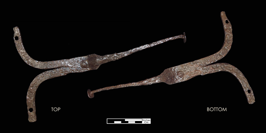
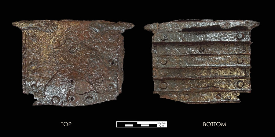
The 28 × 40 ft brick foundation of the barn on the property was exposed by machine excavation. Few domestic artifacts were recovered, all dating to the late 19th or early 20th centuries. A small coal ash deposit and the recovery of parlor stove pieces and a brass bedstead suggest that the building housed one or more persons during all or part of its existence. The artifacts may have been stored in the building when it was no longer used for its intended purposes, but the coal ash deposit clearly indicates heating of at least part of the building. A number of non-domestic artifacts also were recovered, including parts of agricultural implements, equestrian and horse-drawn vehicle hardware, and architectural hardware.
References
1985 A Phase I Cultural Resources Survey for the Calvert Road Relocation, Prince George's County, Maryland. (John Milner Associates, Inc.) MHT # PR 81A.
2013 A Phase II Archeological Site Examination of MacAlpine (18PR259), Calvert Tract, MD Route 1, and Phase III Data Recovery at the MacAlpine Barn, Hyattsville, Prince George's County, Maryland. Preliminary Plan 4-12004. (Gibb Archaeological Consulting) MHT # PR 612.
2008 A Phase I Archaeological Investigation of the Cafritz Property, Prince George's County, Maryland. (Applied Archaeology and History Associates, Inc.) MHT # PR 498.