Longview Beach (18ST51)
Site History
The Longview Beach site (18ST51) is a multicomponent site consisting of a Middle to Late Archaic scatter, an Early to Late Woodland and possible contact period village, and a mid-18th to 20th century farmstead on the Wicomico River in St. Mary's County, Maryland.
Archaeological Investigations
This site was identified in July of 1971 by Barbara McMillan of American University. At the time, it was observed to consist of a lithic scatter on a sandy beach. The main portion of the site may now be inundated. Artifacts collected include ten quartzite flakes and six pieces of fire-cracked rock.
The site was initially given a cursory visit by Scott Strickland and Julia King of St. Mary’s College in 2010 at the invitation of property owner Nancy Wolfe. Observed artifacts at that time included only a large amount of oyster shell and fire cracked rock. The site was revisited in 2015 by Scott Strickland using a systematic surface survey of the property. The survey revealed overlapping prehistoric and historic artifact concentrations. The most substantial concentration included a very large, thick shell midden measuring approximately 1700 by 600 feet. The site boundary of 18ST51 was expanded to include the new areas.
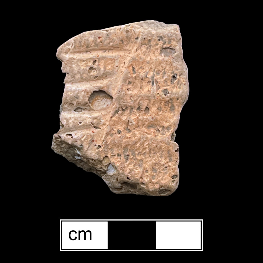
Native artifacts observed included a variety of projectile points and ceramics dating from the Middle Archaic to the Late Woodland and possible contact periods. Diagnostic lithic materials included Guilford, Otter Creek, possible Savannah River, possible Susquehanna Broadspear, Piscataway, Levanna, and possible Madison projectile points. A total of 42 native ceramics were observed. Identifiable diagnostic ceramics included Accokeek, Pope's Creek, Mockley, Townsend, Moyaone, Potomac Creek, and Yeocomico wares. The majority of ceramics were observed clustered within the large shell midden southeast of the Lower Brambly house. One piece of thin sheet copper scrap was also observed within this concentration of ceramics, but it is not known whether this represents part of a later occupation. This copper scrap was tested using X-ray fluorescence against known 17th- and 19th-century examples and compared to copper scrap tested at Jamestown and Werowocomico. The preliminary results of this test show that the copper is most similar to the samples found at Jamestown and Werowocomico.
Due to the scale of the site and the extraordinary amount of native ceramics observed (given the sampling strategy employed), it is highly probable that this represents a large substantial village. It is also possible that this site represents the largest known shell midden in St. Mary’s County in terms of overall footprint. In 1608, Captain John Smith visited a village somewhere in this area, which he called Secowocomoco/Cecomocomoco. On his map, published in 1612, he refers to the village as being the location of a "kings howse." Smith describes the village in his writings as being inhabited by 40 men, referring to the approximate number of warriors. The argument can be made in favor of this site being the same site visited by Smith.
Several concentrations of historic period artifacts were also observed dating from as early as the second quarter of the 18th century up to the present. Observed diagnostic ceramics included Rhenish blue and gray stoneware, blue on white tin glazed earthenware, Staffordshire slipware, manganese mottled earthenware, English brown stoneware, Chinese porcelain, English soft-paste porcelain, white salt-glazed stoneware, Buckley, creamware, dipped wares, pearlware, transfer-printed wares, mochaware, blue edgeware, North American gray stoneware, sponge painted refined earthenwares, white granite, and Rockingham wares.
One concentration of historic materials lay approximately 700 feet northwest of the 1890s Lower Brambley house. A majority of the 18th-century materials were observed in this area. It is unknown who first occupied this part of the site, but documentary records indicate that John Lewellin was likely living there by the mid-18th century. John Lewellin was a member of St. Mary’s County's Committee of Safety and Correspondence in 1774, leading up to the American Revolution, John Lewellin also held the post of tobacco inspector from at least the 1740s to 1780s. He is known to have kept a warehouse that was known as Lewellin's warehouse well after his death in 1785 somewhere nearby or on the property. During the Revolutionary War, it is recorded that provisions were to be collected by an American ship called the Independence in June of 1778. Lewellin was married to a Mary Jordan, and by 1798 a Richard Jordan is in possession of the property. Richard Jordan appears in the 1798 Federal Direct tax record as occupying a brick house measuring 28 feet square, with a kitchen measuring 16 by 20 feet, a barn measuring 32 by 40 feet, and an unidentified outbuilding measuring 18 by 28 feet, as well as taking ownership of one half of Lewellin’s warehouse, complete with grain house, kitchen, and tobacco inspection house.
Oral history of the property indicates that Lewellin's former home burned down in the 1880s and was replaced by the current Lower Brambly house. Oral tradition also holds that there once stood a "Customs house" southeast of the current house near the property line with the Longview Beach subdivision. This customs house may be referring to the warehouse and inspection house described in 1798. A gravestone dated 1759 sits along the beach near the current house and decorated with a Death’s head motif. The stone was discovered after it was used as a step or platform on the outside of the current Lower Brambley house. It is unknown where this gravestone was acquired but it is said that an unmarked cemetery sits at the most northwest corner of the property near the mouth of Bramleigh Creek.
In 2017, Timothy J. Horsley conducted several geophysical surveys of a 92-acre area that encompasses the site. The combination of topsoil magnetic susceptibility survey, magnetometry, and ground-penetrating radar survey has helped to define the extent of potential cultural resources, and provided accurate locations of specific features and broader areas of interest to help guide and inform future investigations of this important site. These results suggest a near-continuous band of prehistoric occupation above the Wicomico River and Bramleigh Creek, broadly coinciding with the visible concentrations of surface shell midden, but also extending beyond it. The 16-acre magnetometer survey extended along the entire length of the Lower Brambly property above the Wicomico River. Away from modern and historic ferrous disturbances, the results reveal numerous buried probable pit and hearth features. It has not been possible to define individual structures, nor is there any clear evidence for a palisade that might have helped to identify this as the site of Secowocomoco. If such a feature had even been present, it is quite possible that it—and its associated settlement—has been lost to shoreline erosion. The results also indicate areas of historic activity at Lower Brambly, including the site of a possible colonial earthfast structure.
A smaller, high resolution GPR survey has revealed a roughly 2 foot-thick, intact shell midden deposit below the topsoil, extending up to around 82 feet (25m) from the buff edge. Additional GPR transects across the huge expanse of surface shell throughout the rest of the field suggest that these thick midden deposits are restricted to a relatively narrow band along the modern shoreline. While further work will be required to fully understand the implications, it appears that the thick midden deposits cover an area of around 1.5 acres, with much thinner, possibly dispersed deposits present throughout the larger 18.5 acres of visible shell that defines the huge southern shell midden at Lower Brambly.
References
2017 Lower Brambly (Secowocomoco) site (18ST51), St. Mary's County, Maryland: Report on geophysical surveys, February 13-20, 2017 for the Archeological Society of Maryland, Inc. (Horsley Archaeological Prospection, LLC) MHT # ST 296.
1972 An Archaeological Survey of St. Mary's County, Maryland. M.A. Thesis, American University. MHT# ST 107.
2015 An Assessment and Review of the Archaeological Resources of St. Mary’s County, Maryland. (St. Mary's College of Maryland) MHT # ST 273.