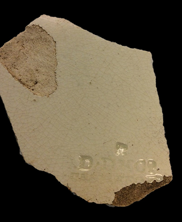
Harper's Creek Site #1 (18ST747)
Site History
The Harper's Creek #1 archaeological site (18ST747) is the multicomponent site consisting of a Woodland short-term resource procurement area and an 18th-20th-century slave/tenant quarters. The site is located along Harper’s Creek within Naval Air Station Patuxent River in St. Mary's County, Maryland.
Site 18ST747 and the nearby site 18ST393 together represent an area of slave cabins for Susquehanna Point Plantation (18ST399), occupied from around 1740 to 1865; occupation continued up to the 1930s. The Harper’s Creek #1 site included two separate cabin sites, both occupied in the 19th and 20th centuries, possibly up to 1942 when NAS Patuxent River was set up. A few 17th- or early 18th-century artifacts were found, but main occupation seems to have begun around 1780.
Susquehanna Plantation has a complex history, granted first in 1649 to Joseph Edloe. John Halfhead, brickmaker, also owned property on Susquehanna Point and there was a protracted lawsuit about the property in the 17th century. Susquehanna was purchased by Christopher Rousby perhaps as early as the late 1660s. He lived there until his death in 1684. The property eventually came to be owned by John Rousby, Jr., and passed through several owners, including George Biscoe. Biscoe owned the property in the late 18th and early 19th centuries, when the structures at 18ST747 are believed to have been built. The Carroll family owned the property in the mid-19th century.
Thereafter, the farm was owned by absentee investors, but it continued to operate as a farm down to 1942, when it was purchased by the federal government and NAS Patuxent River was established. At that time the buildings were torn down — except for the house at Susquehanna, which was moved to the Ford Museum — but the project area continued to be farmed and it is still in agricultural use.
Archaeological Investigations
The Harper's Creek #1 site was identified in 1997 during a survey by Jefferson Patterson Park and Museum of a 460-acre area along Harper's Creek. Artifacts were recovered from 79 of the 128 shovel tests excavated within the defined site. Although a few artifacts hinted at a 17th-centry occupation of the area (two large-bore pipe stems and a sherd of North Devon earthenware) most of the assemblage spanned the late 18th through mid- to late 19th centuries. Galke and Kell also reported a light scatter of prehistoric artifacts across the site, with a slight concentration toward the southern end. No diagnostic bifaces were found. The rather small amount of prehistoric ceramics included at least four different types: Accokeek cord-marked, Mockley cord-marked, Townsend, and Moyaone plain. If these identifications are correct, the site was used occasionally through the Woodland period.
Historic artifacts were found in two distinct locations, separated by a low-lying swale. Enough artifacts were found to indicate the presence of a domestic structure in both locations, and given the large amounts of brick, both loci included a structure with brick foundations. The cut nails suggest that the buildings were constructed after 1800. Artifacts included ceramics, glass, architecture, tobacco pipes, and faunal remains and diagnostics range from North Devon to undecorated and blue transfer printed whiteware. The northern concentration was identified as a 19th-century slave quarter.
In early 2015, the Louis Berger Group conducted Phase II testing off 18ST747 and 18ST393. Site 18ST747 had been defined after a shovel testing survey that was limited to within 200 feet of the creek shore. It seemed likely that the site extended beyond that arbitrary limit. There were also questions about the exact location of site 18ST393, which was found by surface inspection in a plowed field, and whether the Phase II testing of that site had been carried out in the correct location. Therefore, the current investigations began with shovel testing across the project area at 50-foot intervals. In all, 155 shovel tests were excavated, covering an area of about 8 acres. Of those 155 shovel tests, seven produced prehistoric artifacts, 30 produced historic artifacts, and 13 produced both. A handful of objects was also collected from the surface. Comparison of the current testing with the 1997 testing shows that the current testing did not extend to the northern end of site 18ST747, where the highest densities of historic artifacts had been recorded during the earlier study.
As expected, artifacts were found in several parts of the tested area. This included site 18ST747 and the originally mapped location of 18ST393. Artifact concentrations were also found in five other locations extending westward to Cedar Creek Road. One of these was the depression where Julie King and her colleagues had dug two test units during their testing of Susquehanna Plantation. King had called that location site 18ST393. After consultation involving the Navy and the Maryland Historical Trust, it was decided to extend the boundaries of site 18ST393 to cover all of the project area west of site 18ST747 as originally mapped. Within this broad area, six separate loci of activity were defined, with Locus 7 used as a designation for the few artifacts that were outside the activity areas. The area tested by King and colleagues became Locus 1.
Six test units were excavated in 18ST747. These excavations were focused on the location of a structure with brick foundations, which may be shown on the coastal survey maps. Test Unit 2 was placed near a visible brick concentration thought to represent a chimney fall. An intact brick foundation wall was discovered along one edge of the test unit; Test Unit 4 was therefore excavated adjacent to Test Unit 2, to fully expose the wall. The wall consisted of two rows of brick both laid stretcher fashion. Some of the bricks may have been broken before they were placed into the wall, that is, they were originally used as half bricks. Two courses of brick were present, the lower course resting on subsoil but not in a visible trench. An attempt was made to define the size of the structure by probing, but this was difficult because of the amount of brick in the soil. The foundation measured at least 10 feet north-south and at least 6 feet east-west, likely longer in both dimensions. Based on the generalized scatter of brick, the structure may have measured about 16x12 feet. The bricks are handmade and the mortar contains visible shell fragments. which is typical of the 18th or early 19th century. Both hand-wrought and machine-cut nails were found in quantity around the structure.
A test placed on the slope at the northern end of the tested area produced a large amount of fire-cracked rock. Deep, very sandy soils were encountered. Artifacts were recovered from the top three strata, to a depth of 2.0 feet below the surface. The lowest stratum, mineral-stained sand, was sterile. A significant quantity of fire-cracked rock was recovered from the test unit—42 pieces with a combined weight of 800 grams (1.8 pounds). Other prehistoric artifacts include an early-stage quartz biface, 18 pieces of debitage, and two small potsherds, both of them sand-tempered, with smooth surfaces. However, most of this material was recovered from Stratum B, a sandy layer that also contained historic artifacts. The fire-cracked rock was scattered throughout the unit, with no sign of a clear concentration, and therefore no feature was defined.
The historic artifacts from site 18ST747 indicate a long period of occupation, from the 18th century into the 20th. Significant amounts of creamware (1762-1820) and pearlware (1775-1840) and 31 hand-wrought nails (before 1820) represent occupation into the 1870 to 1820 period. There were also a few artifacts suggesting an earlier occupation: single sherds of Midlands Mottled ware (1680-1750), English brown stoneware (1690-1775), and Staffordshire slipware (1670-1795). The site also produced several fragments of machine-made bottle glass (after 1900), a 1908 penny, plastic buttons (after 1930), and a 1939 license plate. It is possible that a few of the latest items were discarded on the site after it had been abandoned, but the collection suggests occupation into the 1930s, and perhaps down to 1942 when the property was acquired by the military.
The prehistoric artifacts represent occasional use of the site throughout the Woodland period. Both the Phase I and II investigations identified smoothed sherds that may date to the very Late Woodland or Contact periods. During the Phase I testing, sherds were found that were identified as Accokeek, an Early Woodland type, and Mockley, which dates to the later Middle Woodland. No projectile points were found.
Sites 18ST393 and 18ST747 taken together provide a great opportunity to study an African-American community across a long span of time. From the early 18th century down to the 1880s, ownership of the plantation descended within one family. It therefore seems likely that some enslaved families may have resided on the plantation for a century or more. Because different spots within these sites were occupied at different times, it is possible to separate the material chronologically and study how the community changed over time. Architectural evidence of the buildings is present, including the foundations of the two most recent cabins. The cellars and the midden feature likely contain significant deposits.
References
2015 Susquehanna Plantation's Back 40: Investigation of a Proposed Rotorcraft Training Course and Phase II Evaluation of sites 18ST393 and 18ST747. (The Louis Berger Group) MHT # ST 274.
2000 Phase I Archaeological Resources Inventory of the Harper's Creek Area, Naval Air Station Patuxent River. (Jefferson Patterson Park and Museum) MHT # ST 184.
1981 Patuxent River NAS Cultural Resources Survey: Preliminary Report and Recommendations for Future Work. MHT # ST 36.