The MAC Lab
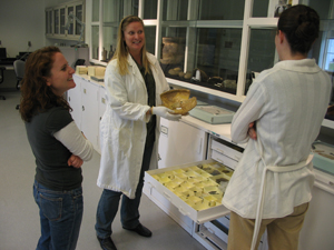
The Maryland Archaeological Conservation Laboratory (MAC Lab) is a state-of-the-art archaeological
research, conservation, and curation facility located at Jefferson Patterson Park & Museum, the State
Museum of Archaeology, in southern Maryland. The MAC Lab serves as a clearinghouse for archaeological
collections recovered from land-based and underwater projects conducted by State, County and Federal
agencies throughout Maryland. The MAC Lab also houses a number of major collections acquired through
private donation to the Maryland Historical Trust. All of these collections are available for research,
education, and exhibit purposes to students, scholars, museum curators, and educators.
About the MAC Lab
Research Sites Hosted by the MAC Lab
The MAC Lab also regularly creates or hosts research tools and finding aids. This site is one example. Other examples
include:
Archaeological Collections in Maryland: This finding
aid to more than 30 of the most important collections
held at the Maryland Archaeological Conservation Laboratory includes a searchable database of the artifacts and field
records from each of those collections.
Diagnostic Artifacts in Maryland: The
Diagnostic Artifacts in Maryland website, created by the MAC Lab in
2002, was designed as an introduction to artifact types commonly found at archaeological sites in Maryland. This
online resource, which uses the extensive MAC Lab collections to create accessible identification tools and resource
materials, has proven invaluable for archaeologists, curators, students and anyone interested in Maryland
and Mid-Atlantic history.
Colonial Chesapeake Cultures: This
web site explores the material dimensions of cultural contact, plantation
development, the rise of slavery and consumer culture through the study of 18 colonial Chesapeake archaeological
sites in Virginia and Maryland.
Maryland Archeobotany: This
unique resource aggregates Maryland’s paleobotanical data in a searchable
format with interpretive summaries that place the information in a publicly-accessible and user-friendly format.
Project components include summaries of archaeological sites bearing plant data, a searchable database of
archaeologically-recovered plant remains, and an interpretive history of Maryland’s landscapes.
Wood and
Charcoal Identification in Maryland: This web site was created to assist in the
identification of carbonized wood samples from archaeological sites. In addition to descriptions of thirty-one
hardwood and softwood species found in Maryland, the site contains high resolution photographs of the cellular
structure of each species, both in carbonized and non-carbonized forms.
Associated Project
Maryland Historical Trust Archeological Synthesis Project:
Much of the data on this site is taken from
the Maryland Historical Trust Archeological Synthesis Project. The MHT Archeological Synthesis Project was launched in
2007 by the Maryland Historical Trust Board of Trustees (with additional funding provided by the MD State Highway
Administration) to begin the process of synthesizing data from the thousands of excavation projects that have been
conducted in Maryland over the past few decades. It consists of a searchable database that is linked to
our Maryland Archeological Site Survey files, but is also tied to synopsis reports and cover sheets generated
by reviewing each larger excavation project. The synopsis reports contain a capsule summary of the
overall site report, organized in a way that makes it easier for researchers to quickly pull out the
most relevant information they would need for reconstructing the past activities at a site. The cover sheets
deal more with the history of archeological activity at a site: specifically the justifications for fieldwork, research
objectives, and the potential for future research at the locale.
Use and Access: Use of the Archeological Synthesis Database is available in two forms: a Public Access version
and a Professional Access version. Geographic locations and site setting information within the Public Access
version of the database are intentionally vague to protect site locations. Latitude and Longitude data is only
accurate to within 1 square mile of each site. This option is suitable unless you are a
professional archeologist. The Professional Access version of the database includes detailed site
location information and is only available to authorized archeologists, agency representatives, and other
researchers who meet the Secretary of the Interior's Professional Qualification Standards and who currently
have a Medusa Account. Search functionality and the universe of sites within the database
are identical in both versions.
For questions about the Archeological Synthesis Project or to make research inquiries, please contact Dr.
Matt McKnight at (410) 697-9572.